Buying on the water in Tampa can feel like learning a new language. You see listings touting oceanfront, intracoastal, and canal, but the reality in Hillsborough County looks different from what you may know in Miami or Palm Beach. If you want the right dock, the right depth, and the right lifestyle, clarity matters. In this guide, you’ll learn how Tampa Bay waterfront really works, the access and maintenance factors to verify, and how to match a property to your boating plans. Let’s dive in.
Tampa waterfront types explained
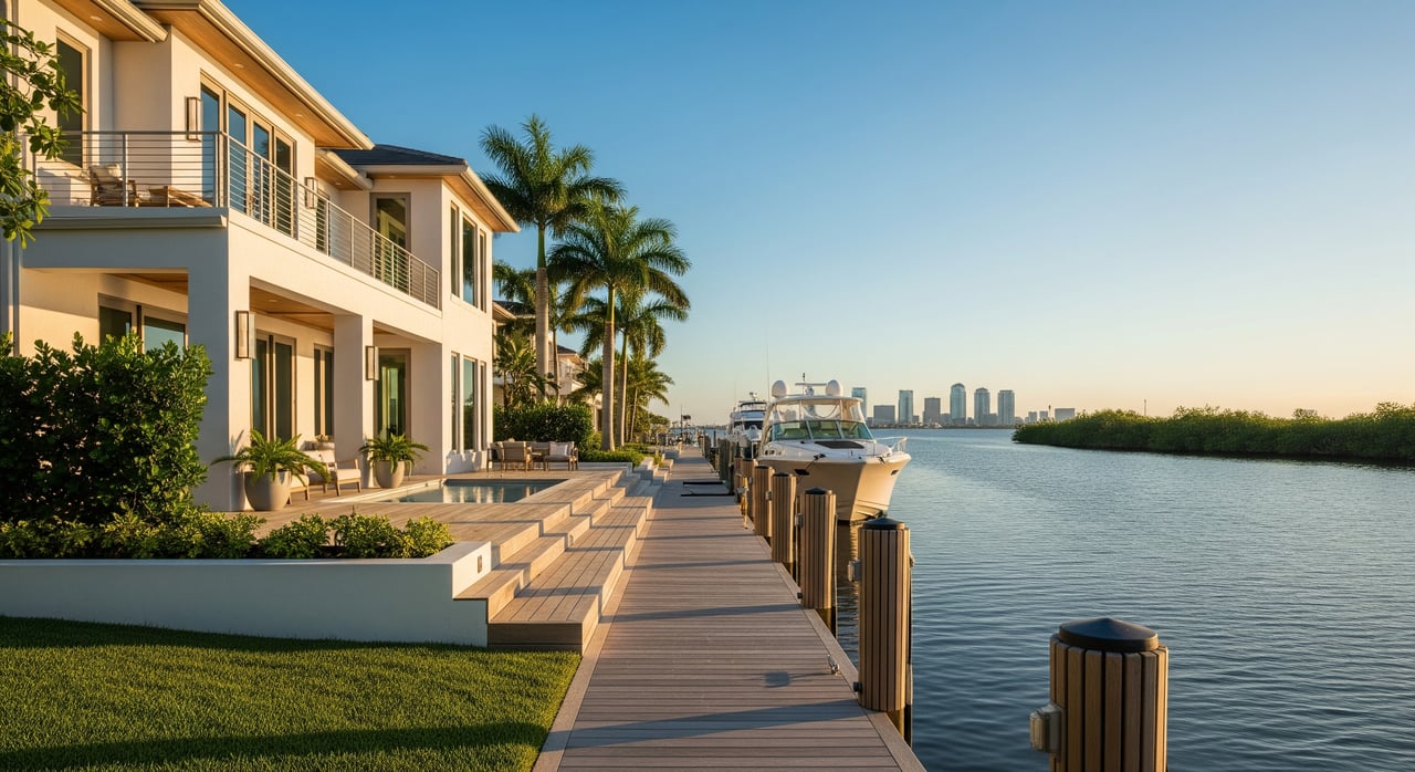
Where “oceanfront” fits in Tampa
You won’t find Atlantic-style oceanfront in Hillsborough County. Local waterfront faces Tampa Bay and its coves. That bayfront lifestyle can feel like oceanfront in day-to-day use, but it is an estuary with tides and shipping activity. Wave energy is usually gentler than open Gulf beaches, yet surge and traffic still matter.
Bayfront on Tampa Bay
Bayfront homes sit on Tampa Bay, Hillsborough Bay, or Old Tampa Bay. Many enjoy broad views and faster routes to marked channels. You should expect tidal influence and occasional wakes, especially near commercial routes. To understand the traffic picture and ship movements, review updates from Port Tampa Bay.
Canal-front neighborhoods
Canal homes are common in South Tampa and coastal communities to the south. Canals range from shallow, narrow waterways suited to smaller boats to deeper, well-maintained channels. Depth varies street by street, so verify draft at the dock and along your exit route using NOAA nautical charts and local knowledge.
Riverfront homes
Riverfront along the Hillsborough River and smaller tributaries offers protected water and a different feel. Water can be brackish, and bridges may limit mast height for sailboats. Some stretches run shallow during low flow, so route planning is essential.
Intracoastal access defined
On Florida’s west coast, the Gulf Intracoastal Waterway connects protected routes, but in Tampa you’ll primarily travel through Tampa Bay’s marked channels to reach it or the open Gulf. Listing remarks that mention “Intracoastal access” usually point to proximity to a navigable, protected route. Confirm what that means for a specific property before you rely on it.
Boating access and navigation
Depth and draft
Depth at your dock is the first filter. Many canals here were dredged for small recreational boats, so larger vessels with 2 to 3 feet of draft or more may face restrictions. Shoaling changes over time, and charted depths can differ from current conditions. Cross-check charts with on-site measurements and tide data from NOAA Tides and Currents.
Bridge clearances
Your route may include fixed bridges. If you have a sailboat or a large center console with a tall structure, verify vertical clearance at mean high water and whether any drawbridges are on a schedule. Plan for those timing windows if you take regular trips.
Distance to the Gulf
Even bayfront properties in Tampa typically navigate through the ship channel and out of the bay to reach the Gulf. That can mean longer run times compared to many Atlantic ICW stretches. If quick, no-bridge access is your priority, focus your search on the shortest, clearest routes to the main channels.
Currents and commercial traffic
Tampa Bay supports commercial shipping, so you will encounter large vessels and associated wakes. Currents and tides are manageable but still affect docking and maneuvering, especially on windy days. For a sense of traffic patterns, use port resources and local mariner updates from Port Tampa Bay and navigation information on NOAA charts.
Mooring options
Waterfront properties in Hillsborough may include:
- Private fixed or floating docks
- Community or assigned slips
- Marina slips available for lease
If a listing mentions riparian rights, that refers to an upland owner’s right to reasonable access, which is still subject to environmental and navigation rules. If you’ll rely on a community dock or marina, understand the rules, waitlists, and transfer policies upfront.
Permits, ownership, and maintenance
What to verify before you bid
- Dock and seawall permits. Confirm that the structures were permitted and built to code. Check local records with the City of Tampa or Hillsborough County.
- Seawall condition and responsibility. Many owners are responsible for repair or replacement. Ask for inspection reports and maintenance history.
- Dredging history and rights. Some areas require periodic dredging. Private dredging needs permits and can be expensive. Look for community dredge districts or special assessments.
- Riparian rights and access. Determine whether dockage is deeded or governed by an HOA or marina agreement.
- Environmental limits. Seagrass beds, mangroves, and habitat rules affect dock size, lighting, and placement. Guidance and permits come from the Florida Department of Environmental Protection and the U.S. Army Corps of Engineers, Jacksonville District.
Agencies and approvals
Work in navigable waters typically involves state and federal review. Expect coordination among:
Local shoreline type, tidal range, and habitat drive what is allowed. Plan for a longer lead time if you intend to modify docks or seawalls after closing.
Lifespans and costs
- Seawalls and bulkheads eventually require repair or replacement. Exposure, materials, and boat traffic influence lifespan.
- Docks need routine maintenance, especially if wood. Composite options extend intervals between replacements.
- Dredging, when needed, is episodic and costly. Get clarity on who pays and how often.
Insurance, flood, and building codes
Flood zones and elevation
Most waterfront addresses sit in Special Flood Hazard Areas. Lenders require flood insurance if a structure touches an SFHA. Before you write an offer, identify the current FEMA designation and ask for an elevation certificate. You can verify flood maps through the FEMA Flood Map Service Center.
Coverage and premiums
NFIP and private carriers offer flood policies. Premiums align with risk, elevation, and claims history. Windstorm exposure drives homeowners insurance and hurricane deductibles. Newer construction, impact openings, flood vents, and higher elevations can qualify for mitigation credits.
Codes and post-storm work
Florida Building Code includes coastal standards that affect repairs and rebuilds. After storms, temporary rules may streamline some repairs, but documentation helps. Keep organized records of permits, elevation certificates, and photographs for future claims.
HOA, marinas, and lifestyle trade-offs
Slip access and rules
HOAs and marinas commonly manage:
- Deeded private docks at a home
- Assigned slips with waitlists
- First-come community docks
- Leased slips at a nearby marina
Review boat length, beam, and draft limits; liveaboard rules; insurance requirements; and whether slips transfer at sale. Ask about assessments for seawalls and dredging.
Pros and cons to weigh
- Pros: Instant access to boating and fishing, strong views, and potential resale appeal in select markets.
- Cons: Higher maintenance and insurance costs, more rules, possible noise from traffic and marinas, and added complexity with permits and environmental constraints.
Buyer checklist for waterfront due diligence
Use this list before you tour and again while under contract:
- Confirm the waterfront type: bayfront, canal, river, or tidal creek.
- Request copies of dock and seawall permits and as-built drawings.
- Identify who maintains the seawall and dock and whether there are recorded agreements.
- Get the depth at mean low water at the dock and along the route. Match it to your boat’s draft.
- Map bridge clearances and any drawbridge schedules on the route to open water.
- Clarify whether riparian rights are deeded or governed by an HOA or marina agreement.
- Ask about flood history and any claims related to storms or red tide impacts. For current bloom info, consult the Florida Fish and Wildlife Commission’s red tide updates.
- Pull the FEMA flood zone and any available elevation certificate from the FEMA Map Service Center.
- Check for pending dredging or seawall projects and related special assessments.
- Review HOA or marina rules: boat size limits, liveaboard policies, slip transferability, and waitlists.
- Consider a marine structural inspection of the seawall and dock.
Tampa vs. Miami–Palm Beach: key differences
- Waterbody and feel: Tampa Bay is an estuary with commercial shipping and marked channels. The Atlantic side often features barrier islands with open ocean beaches and a different ICW rhythm.
- Run times: Expect longer transits from many Tampa addresses to the open Gulf compared to some Atlantic ICW segments.
- Environmental patterns: West Florida experiences Gulf red tide events. Stay informed through FWC red tide resources and regional updates. For broader bay health and context, the Tampa Bay Estuary Program is a helpful reference.
Smart next steps
- Bring your boat profile to each tour: length, draft, beam, and clearance needs.
- Pre-screen permits and flood data before negotiating price.
- Validate depth and tides on-site using NOAA charts and Tides and Currents.
- If you plan dock upgrades, speak with FDEP and USACE Jacksonville early, and confirm local rules with the City of Tampa or Hillsborough County.
When you want a clear, data-led plan for a Tampa Bay waterfront search that fits your boating and lifestyle goals, connect with Unknown Company. We bring a discreet, high-touch process that focuses on the right property, the right access, and the right long-term ownership experience.
FAQs
What does “oceanfront” mean for Tampa waterfront buyers?
- In Hillsborough County, you are buying bayfront, canal, or riverfront rather than Atlantic oceanfront; daily use can feel similar, but conditions reflect an estuary with tides and commercial traffic.
How do I confirm bridge clearances on my route to the Gulf?
- Check local bridge data and verify on the water with NOAA nautical charts and tide information from NOAA Tides and Currents.
Which permits are needed to build or modify a dock?
- Dock work typically involves approvals from the Florida Department of Environmental Protection, the U.S. Army Corps of Engineers Jacksonville District, and local permits from the City of Tampa or Hillsborough County.
How does red tide impact Tampa Bay waterfront ownership?
- Red tide is episodic on Florida’s Gulf coast and can affect water use and perception; monitor current conditions through the FWC red tide page.
What flood steps should I take before buying a canal or bayfront home?
- Pull the property’s FEMA flood zone and any elevation certificate from the FEMA Map Service Center, then get insurance quotes and consider mitigation features like elevation and impact openings.